
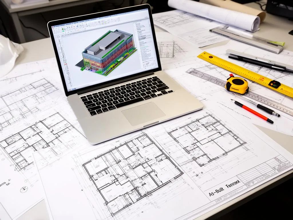
3D laser scanning for architects answers the first question of every renovation in Phoenix: what is really there? Original drawings for a 1970s strip center or a tilt-up warehouse are often missing, partial or wrong after decades of tenant changes. A laser scan measures the building as it stands, and you get as-built drawings, a Revit model or the point cloud itself, ready to design on. This page explains which deliverables architects order, how much detail is worth paying for, how the City of Phoenix process fits in, and what to send us for a quote. For every field we work with, see 3D laser scanning by industry.
What architects in Phoenix use 3D laser scanning for
Architects call us when the design depends on the existing building and nobody trusts the old set. The jobs repeat across the Valley.
Tenant improvements and change of use
A new tenant, a new use, a new layout. The design team needs walls, doors, ceiling heights, columns and visible utilities where they actually are, because an error of a few inches on a corridor or a restroom clearance turns into a redesign at plan review. Existing conditions from a scan let you start the schematic layout the week the files arrive.
Strip retail and pad buildings
Much of Phoenix commercial stock is single-story retail from the 1960s to the 1980s, remodeled many times. Expect demising walls that moved, soffits that hide old ductwork, and rooftop units that were swapped without drawings. We scan the suite, the roof where access is safe, and photograph what the scanner cannot see.
Tilt-up warehouses becoming something else
Concrete tilt-up buildings along the I-10 and I-17 corridors get converted to showrooms, gyms, light manufacturing and offices. The tall, open volume scans fast, but the details that drive the design (panel joints, roof structure, clear height under the joists, dock openings) need to be captured on purpose. Say in your request what the conversion needs.
Additions and adaptive reuse
An addition has to tie into existing floor levels, roof heights and structure. Adaptive reuse goes further: you need the whole building in 3D to test what fits. A scan to BIM Revit model is the usual deliverable here, because the design will be developed in Revit anyway.
Checking what got built
During construction administration, a scan of a phase that is about to be covered shows whether framing, openings and penetrations match the drawings. That work is usually ordered by the contractor; see construction laser scanning in Phoenix for how contractors scope it.
Laser scanning deliverables architects order
Pick the deliverable from the job, not from the technology. This table is the short version.
| Your job | Deliverable worth ordering | Level of detail | Service |
|---|---|---|---|
| Small TI, permit or CO set | 2D floor plan (DWG + PDF), site photos | Walls, doors, windows, ceiling heights, fixtures, visible utilities | As-built drawings |
| TI with ceiling and MEP work | Floor plan + reflected ceiling plan + roof plan | Add ceiling grid, lights, diffusers, rooftop units | Scan to CAD |
| Addition or adaptive reuse | Revit model (RVT) + point cloud | Walls, floors, roofs, openings, visible structure (about LOD 200 to 300) | Scan to BIM |
| Your team models in-house | Registered point cloud (RCP/RCS or E57) | Raw measured data, cleaned and registered | Point cloud services |
| Facade or historic detail | Elevations and sections, point cloud | Openings, trim and profiles you name | As-built drawings |
2D as-built drawings in DWG
Most of the quote requests we receive ask for 2D plans. An AutoCAD floor plan drawn from the point cloud is faster to produce than a model and drops straight into a permit set.
Floor plans
The plan is drawn at the scale you work in, on your layer standard if you send one.
What is drawn by default
- Walls with measured thickness, doors and windows with sizes and swing
- Columns, stairs, ramps, plumbing fixtures and built-in casework
- Ceiling heights noted per room, and visible utilities such as panels and water heaters
- Room names you give us, and overall dimensions
Excluded unless you ask
Furniture, loose equipment, hidden conditions above a closed ceiling or inside walls, and anything the scanner cannot see. Those areas are clouded on the sheet with a note, so nobody mistakes a gap for a measurement.
Reflected ceiling plans, elevations and sections
A reflected ceiling plan records the grid, light fixtures, diffusers and soffits. Elevations and sections come from the same point cloud, so you can order them later without a second site visit, as long as the area was scanned.
Revit models from the laser scan
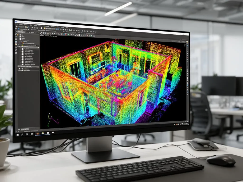
A Revit model (RVT) from the scan gives you walls, floors, roofs, openings and visible structure as native elements you can design on.
Level of detail worth paying for
More detail costs more modeling hours. Order the detail the design needs and keep the point cloud for the rest.
LOD 200 vs LOD 300 for existing conditions
For most renovations, generic walls and openings in the right place (about LOD 200) are enough for space planning; accurate wall types, sizes and openings (about LOD 300) suit construction documents. Ornament, piping and every duct run rarely pay for themselves. Our guide to scan to BIM LOD explains each level with examples.
The point cloud itself
Every project starts as a registered point cloud. Ask for it even when you order drawings: it lets your team check a dimension later from the desk.
File formats
E57 opens in almost every tool; RCP/RCS is what Revit and AutoCAD read through ReCap; LAS is common for outdoor and site work. Plans come in DWG and PDF, models in RVT, photos in JPG.
City of Phoenix permits: where the laser scan fits
Architects in Phoenix use scans most often for work that goes through the City of Phoenix Planning and Development Department. Two cases come up.
Certificate of Occupancy for an existing building
The City's Certificate of Occupancy Customer Packet (TRT/DOC/00340) covers existing buildings used as-is, with no work proposed and no change of occupancy. Its eligibility questionnaire carries a $150 review fee, and the City says it replies with the result in 10 working days. Its existing building checklist asks for two drawings.
Floor layout drawing
At an architectural scale (the packet gives 1/4" = 1'-0" as an example): the complete floor layout including equipment, the use of each room, dimensions of rooms, corridors and doors, and the occupancy classification of adjoining suites. A scan gives you every dimension on that list; room uses and occupancy classifications come from your team.
Site layout drawing
At an engineering scale (the packet gives 1" = 20'): lot size and shape, property lines with dimensions, buildings and distances, streets, alleys, easements, and dimensioned parking spaces and aisles. We can measure buildings, parking striping and drive aisles. Property lines and easements need a licensed Arizona land surveyor or the recorded documents; we can refer a surveyor.
Tenant improvements and change of occupancy
If there is construction work or a change of use, the project goes through the City's permit and plan review instead, and the design team needs a full existing-conditions base before drawing the new layout. That base is the same scan and the same plans, just with more of the building drawn.
Who seals what. Our drawings are measured, non-certified informational deliverables. Floor plans used in a permit or Certificate of Occupancy package are typically sealed or submitted by your architect or design professional. We never tell a client the City accepts our drawings on their own. Our guide to as-built plans for a Certificate of Occupancy in Phoenix walks through the full packet.
How to scope 3D laser scanning for an architecture project
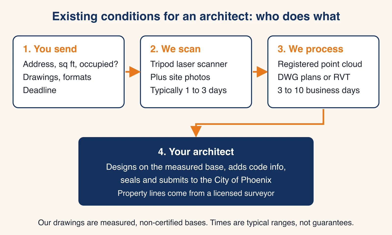
- Consultation. We confirm what the design needs, the deliverables, the deadline and site access, then send a quote.
- On-site scanning. Typical commercial scanning takes 1 to 3 days depending on size, with interior and exterior photos on request.
- Processing. All scan positions are registered into one point cloud and cleaned of noise.
- Drafting or modeling. Plans or the Revit model are produced, typically in 3 to 10 business days.
- Delivery and follow-up. Files arrive in your formats; questions, extra extractions and reasonable revisions are part of the job.
What to send for a quote
- The address, the approximate square footage and the number of buildings or floors
- Whether the building is occupied, and when access is possible
- The deliverables (floor plan, ceiling plan, elevations, Revit model, point cloud) and the formats
- Your layer standard or a title block, if you have one
- The deadline, and the submittal or meeting it feeds
Request a scanning quote for your architecture project with that list and we reply within one business day.
Occupied buildings and inaccessible areas
Most buildings we scan for architects are open for business. We work around staff and customers, and evening or weekend scanning may be available at premium rates. Locked rooms, closed ceilings and roofs without safe access are documented with photos and clouded on the drawing with a note, so your team knows exactly what was not measured.
Price, accuracy and turnaround
Most commercial scanning projects in Phoenix fall between $2,500 and $15,000, depending on size, complexity, level of detail, deliverable type, access, travel and timeline. Typical accuracy is ±2 to 6 mm at normal working ranges. Rush delivery may be available at premium pricing. The quote lists every cost driver for your building.
A quote request from an architecture firm (anonymized)
This is a real request we were asked to quote, not a finished case study. It is typical of what Phoenix architects send.
What the firm asked for
An architecture firm needed as-built floor plans for a City of Phoenix Certificate of Occupancy submittal on an occupied collision center: three buildings, about 7,300 sq ft in total. The list: wall dimensions, ceiling heights, door and window sizes, visible utilities, rooftop units and photos. Files in PDF, DWG and JPG, and explicitly no hosted Matterport links. Like most requests, it asked for the fee and the earliest date.
Worked timeline (illustrative)
Illustrative arithmetic using our published ranges, not a promise for any project. Quote reply: 1 business day. Field work for 7,300 sq ft across three small buildings: 1 day, the low end of the 1 to 3 day range. Drafting the plans and roof notes: 3 to 10 business days. From site visit to files: 4 to 11 business days, so roughly one to two and a half calendar weeks. A two-week deadline is realistic only if access is granted in the first days, which is why the request should state the deadline up front.
A design-build firm sent a different kind of request: a 3D BIM model of 5 to 6 buildings, about 50,000 sq ft in total, in Old Town Scottsdale. That one points to a Revit deliverable and a longer schedule. If your project is in Scottsdale, see 3D laser scanning in Scottsdale.
Laser scanning for the rest of the project team
The same point cloud serves people who come after the design. Contractors use scans to verify work before it is covered; see laser scanning for contractors. Owners and property managers use the floor plans for leasing and space planning; see facility scanning for facility managers. Ordering the scan once, with all three uses in mind, is cheaper than scanning twice. When you are ready, send us the building and the deadline.
Frequently asked questions
What does a 3D laser scanner do for an architect?
A terrestrial laser scanner measures millions of points on every surface it can see from each tripod position. Registered together, those positions form a point cloud of the whole building. Your floor plans, elevations, sections or Revit model are then drawn from those measurements instead of from hand notes.
How much does 3D laser scanning cost for an architecture project?
Most commercial scanning projects in Phoenix range from $2,500 to $15,000. Size, complexity, level of detail, the deliverable (2D plans or a Revit model), access, travel and deadline move the price. Send the address, square footage and the drawings you need and we reply with a fixed quote within one business day.
What is the best 3D scanner for architecture?
For drawings and models of a commercial building, a tripod-mounted terrestrial laser scanner gives the most dependable millimeter-level data. Mobile and handheld scanners are faster but usually less accurate. Rather than asking for a brand, ask the provider for the accuracy they will deliver, the file formats and what is drawn by default.
Should an architecture firm buy a laser scanner or hire a scanning service?
Buying makes sense only if you scan often and have staff to register and clean point clouds. Most firms hire out because the scanner, the processing software and the time to learn both cost more than a few projects a year. A service also takes on the field days, which matters on occupied sites in the Phoenix heat.
Will the City of Phoenix accept your as-built drawings for a permit or Certificate of Occupancy?
Our drawings are a measured, non-certified base. The submittal is typically prepared, sealed or submitted by your architect or design professional, who adds the code information. Items like property lines need a licensed land surveyor; we can refer one.
Do you deliver Matterport links or files?
Files. Plans come as DWG and PDF, models as RVT, point clouds as E57 or RCP, and site photos as JPG. You do not need a hosted viewer account to open them, which is what architecture firms usually ask for.
Can you scan an occupied building?
Yes. Most of the buildings architects send us are in use. We plan scan positions around staff and customers, and after-hours or weekend scanning may be available at premium rates when daytime access is not workable.