
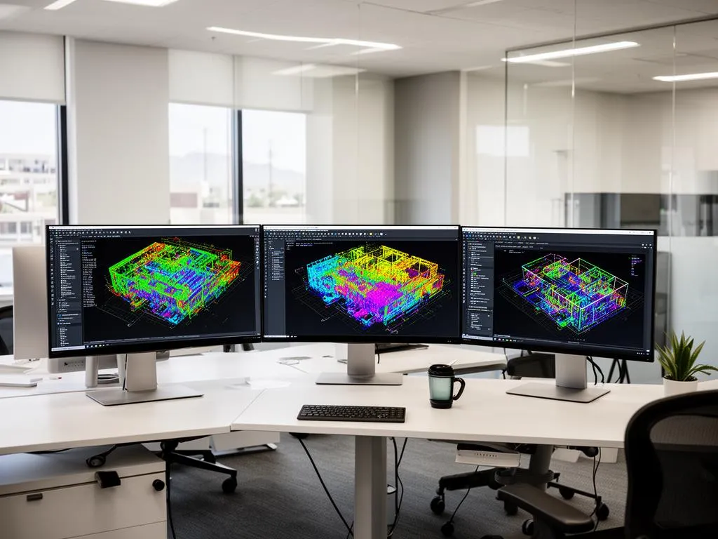
Point cloud file formats at a glance
A laser scan is millions of measured points, each with X, Y and Z coordinates and usually intensity and color. Point cloud file formats differ in what else they keep (scan positions, photos, classification, coordinate system) and in which software can open them. This guide compares the formats from their official specifications and vendor documentation, so you can tell a scanning provider exactly what to deliver. If you would rather have the scan captured, registered and delivered in the right files, see our point cloud services in Phoenix.
The short rule. Ask for the format your team's software opens: RCP/RCS for Revit, AutoCAD and Navisworks, LAS/LAZ for GIS and civil tools. Then ask for the same registered scan in E57 as the copy you keep.
| Format | Owner / standard | Encoding | Keeps | Best for |
|---|---|---|---|---|
| E57 (.e57) | ASTM E2807, open | Binary + XML | Points, color, intensity, 2D images, multiple scans | Exchange between platforms, archive |
| RCP / RCS | Autodesk, proprietary | Indexed binary | Points, color, intensity, scan grouping | Revit, AutoCAD, Navisworks |
| LAS / LAZ | ASPRS, open (LAZ is compressed LAS) | Binary | Points, GPS time, classification, coordinate system | GIS, terrain, aerial and mobile lidar |
| PTS / PTX | Leica, de facto | Text | Points, intensity, color; PTX adds each scan's transform | Legacy Leica workflows |
| XYZ / TXT | None (convention) | Text | Coordinates, maybe color | Last-resort exchange, scripts |
| PLY | Stanford, open | Text or binary | Points or meshes, custom properties | Meshes, graphics, photogrammetry |
| PCD | Point Cloud Library | Text or binary | Points with any fields | Robotics and research code |
The main point cloud formats, one by one
E57: the open exchange format
E57 is defined by ASTM E2807, Standard Specification for 3D Imaging Data Exchange, developed by ASTM committee E57 (hence the name). ASTM lists the current designation as E2807-11 reapproved in 2026. An E57 file stores 3D points, their color or intensity, and 2D images taken by the imaging system, in a mix of binary and XML, with all quantities in SI units. Because it can hold several scans and their photos in one file, it is the format to keep after a project ends: any future software can read it.
RCP and RCS: the Autodesk working format
Autodesk ReCap converts raw scan data into RCS scan files and RCP project files. An RCP is an aggregation of RCS files: the project file points to the scans, and the scans hold the points. Per the AutoCAD help, both can be attached to a drawing much like an external reference. Keep the RCS files in the folder structure the RCP expects; move them and the project opens empty.
LAS and LAZ: the geospatial format
LAS is owned by the American Society for Photogrammetry and Remote Sensing (ASPRS) and recognized by the Open Geospatial Consortium as a community standard. The current edition is LAS 1.5, approved in August 2025. It removed support for the legacy point record formats 0 to 5, added minimum and maximum GPS time to the header, and widened coordinate system support to all published WKT versions. LAZ is the compressed form of LAS, common for large aerial and mobile datasets.
What sets LAS apart is classification. The LAS 1.5 format definition lists standard classes such as 2 ground, 6 building, 7 low noise, 9 water and 17 bridge deck, plus classes added in recent editions such as 19 overhead structure and 21 snow. For a building interior, classes matter less; for a site, a corridor or a roof survey, they let a civil team filter ground from everything else.
LAS point record formats you will see
LAS 1.5 defines point record formats 6 to 10. Format 7 is format 6 plus 16-bit red, green and blue channels, with a minimum record length of 36 bytes per point. If you want color in a LAS delivery, ask for format 7 or higher.
PTS, PTX and XYZ: text formats
PTS and PTX come from Leica's Cyclone software. PTS is a plain list of points with intensity and color. PTX adds a header per scan with the scanner position and transformation matrix, so the scans can be put back together. XYZ and TXT are a convention rather than a standard: the first three columns are coordinates, the rest depend on who wrote the file. Text formats are easy to read and very large. Use them only when nothing else is accepted.
PLY and PCD: graphics and robotics formats
PLY was built for polygon meshes and also holds points with custom properties. PCD is the native format of the Point Cloud Library used in robotics and computer vision. Both are fine for research and visualization, and neither carries the scan structure or coordinate system a building team expects.
Which point cloud file format to ask for
The choice follows the software that will open the file, not the scanner that captured it.
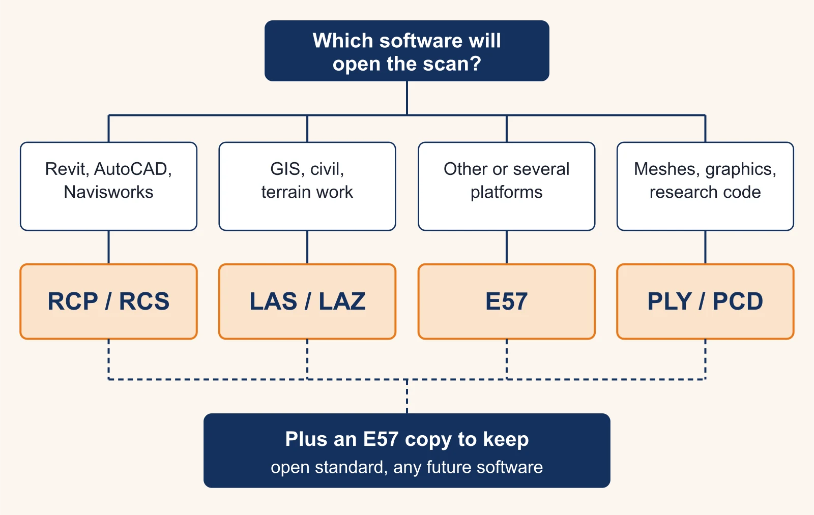
| Your team uses | Working format | Also ask for |
|---|---|---|
| Revit, AutoCAD, Navisworks | RCP with its RCS files | E57 of the same registered cloud |
| Civil 3D, GIS, terrain tools | LAS or LAZ, with the coordinate system stated | E57 |
| Leica, Trimble, FARO or other scanner software | E57 | Nothing else needed |
| CloudCompare or open-source tools | E57 or LAS | Nothing else needed |
| Mesh, visualization, 3D printing | PLY or OBJ mesh | E57 of the source cloud |
E57 vs RCP
E57 vs RCP is not a contest: they do different jobs. E57 is the open file you can hand to anyone. RCP is the indexed file Autodesk software opens quickly, but other software mostly cannot. Revit, per the Revit help, links indexed RCP and RCS files; if you pick a raw format file, its indexer converts it first and you insert the result. So a Revit team gets both: RCP to work, E57 to keep.
How the cloud lands in Revit
When you insert an RCP, Revit offers positioning options: center to center, origin to origin, by shared coordinates, or origin to last placed. A cloud registered to a site coordinate system lands correctly only if you choose by shared coordinates and your model's survey point matches. Ask your provider which coordinate system the cloud is in and which option to use. It saves the most common first-day problem: a scan that floats far from the model.
E57 vs LAS
E57 vs LAS is a question of building versus site. E57 keeps scans as separate setups with their photos, which suits interiors and facades captured with a terrestrial scanner. LAS keeps a single classified cloud with a declared coordinate system and GPS time, which suits terrain, corridors and aerial or mobile lidar. For an outdoor site, ask for both: LAS for the civil team, E57 for everything else.
Converting between formats: RCP to E57 and others
Autodesk's ReCap supported formats list shows the asymmetry. ReCap imports E57, LAS, PTS, PTX, RCS, TXT, XYZ, XYB and several scanner-brand formats (FARO FLS and FWS, Leica PTG, Topcon CL3 and CLR, Riegl RDS, Z+F ZFS). It exports only E57, PTS and RCP/RCS. Its export page splits E57 into structured (complete) and unstructured (3D only).
- RCP to E57: one step in ReCap. Choose structured E57 if the receiver will process the scans further.
- RCP to LAS: not a ReCap export. Export E57, then convert in a tool that writes LAS.
- E57 or LAS to RCP: import into ReCap, or let Revit's indexer do it.
- Anything to XYZ: possible almost everywhere, and you lose scan structure, images and metadata.
The free CloudCompare reads and writes E57, LAS, PLY and PCD, and reads PTX and FARO files, which makes it a common bridge. Keep the original files and convert copies.
How big will the file be? A worked example
File size is the question nobody answers until the download link arrives. Here is the arithmetic for one format, with illustrative numbers.
Illustrative example. A registered, cleaned cloud of a two-story office building is decimated to 400 million points. Delivered as LAS point record format 7 (coordinates plus color), each point takes at least 36 bytes. 400,000,000 × 36 bytes = 14,400,000,000 bytes, about 14.4 GB before compression. The same cloud as LAZ is much smaller, and as XYZ text it is larger. Full-density clouds of the same building can hold several times more points.
Two practical consequences. First, agree on point spacing before delivery: a cloud for floor plans does not need the density of one for MEP modeling. Second, agree on how files are delivered, usually a cloud file share, and how long the link stays live. Our guide to scan to BIM LOD explains how the modeling level you choose drives the density you need.
What to ask a scanning provider for
Requests we are asked to quote around Phoenix show how the format follows the use:
- A sports performance company asked for a high-density scan of part of an outdoor turf field with a 5 mm accuracy target, delivered as a registered point cloud in E57.
- An architecture firm asked for as-built plans, ceiling heights and photos for a City of Phoenix Certificate of Occupancy submittal, in PDF, DWG and JPG, and specifically no hosted 3D tour links. A browser tour is not a point cloud file and does not replace DWG drawings or an E57.
- Design-build and property teams asking for Revit models or 2D CAD usually want the RCP for their own checks, next to the RVT or DWG.
Write these lines into the request: registered or per-scan; formats (working format plus E57); LAS point record format if you need color; coordinate system and units; point spacing or decimation; whether scan photos are included; and how files are delivered. If you are ready to send it, request a quote with your format list. For the full scope we offer, see our point cloud services in Phoenix.
Frequently asked questions
What is the best file format for point cloud data?
There is no single best one. For buildings, ask for the format your software opens (RCP/RCS for Revit and AutoCAD, LAS/LAZ for GIS) and an E57 copy to keep, because E57 is an open ASTM standard that most point cloud software reads.
What software can open point cloud files?
Revit and AutoCAD link RCP and RCS files; Autodesk ReCap converts E57, LAS, PTS, PTX, XYZ and several scanner formats into them. CloudCompare, a free open-source tool, reads and writes E57, LAS, PLY and PCD and reads PTX and FARO files. Scanner software from Leica, Trimble and FARO reads E57.
What are the main types of point cloud file formats?
Four families: open exchange (E57), geospatial (LAS and its compressed form LAZ), indexed software formats (Autodesk RCP/RCS, scanner-brand formats), and text or graphics formats (PTS, PTX, XYZ, PLY, PCD). Pick by the software that will open the file.
What are the different types of point clouds?
A structured point cloud keeps each scan as a grid of rows and columns tied to the scanner position, which helps registration and later processing. An unstructured cloud is just a list of points. ReCap, for example, exports E57 either structured (complete) or unstructured (3D only).
How do I convert RCP to E57?
Open the RCP project in Autodesk ReCap and export it. ReCap lists E57 structured (complete), E57 unstructured (3D only), PTS, PCG and RCP/RCS as export formats. It reads LAS but does not list LAS as an export, so RCP to LAS needs another tool.
Can Revit open an E57 or LAS file directly?
Revit links indexed RCP and RCS files. When you pick a raw format file, Revit's indexer converts it to an RCP plus one or more RCS files first. Asking your scanning provider for RCP saves that step and the guesswork about units and position.