
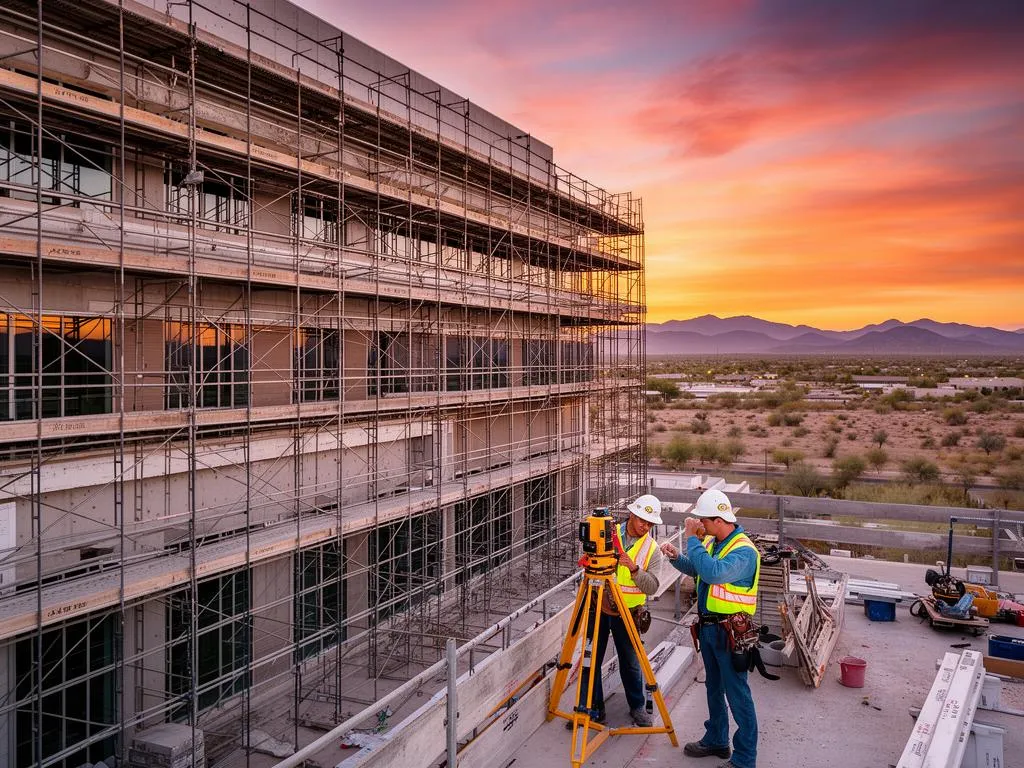
LiDAR vs 3D laser scanning is less a contest than a question of platform. Both send out laser light, time the return and turn each measurement into a point. A tripod-mounted terrestrial laser scanner is, strictly speaking, a ground-based LiDAR instrument. What changes is where the sensor sits, how far it measures, and how much detail lands on each square meter. If you are weighing LiDAR scanning in Phoenix for a building or a site, the short answer is: tripod scanning for buildings and anything drawn to millimeters; airborne or drone LiDAR for terrain over large areas.
Verdict: pick tripod 3D laser scanning for interiors, facades, roofs with equipment, as-built drawings, Revit models and tight tolerances (published accuracy 2 to 6.4 mm at 10 to 50 m). Pick airborne or drone LiDAR for topography, drainage, large parcels and vegetated ground (USGS standard: 10 cm vertical). Pick mobile LiDAR for long corridors. Combine them when a project needs both detail and coverage.
Is laser scanning the same as LiDAR?
The physics is the same. NOAA describes lidar, light detection and ranging, as a remote sensing method that uses laser light to measure distances, and notes that airplanes and helicopters are the most common platforms for mapping broad areas. A 3D laser scanner does the same measurement from a tripod, a few meters to a few hundred meters from the surface.
The words split by industry habit:
- "LiDAR" in mapping and surveying usually means airborne, drone or vehicle systems that cover large areas and tie every point to GPS coordinates.
- "3D laser scanning" in architecture and construction usually means tripod scanners set up at many positions inside and around a building.
- "LiDAR" on a phone or a car means something else again: small sensors for room capture, autofocus, robots and driver assistance.
One common claim is wrong: that LiDAR measures a single target while a laser scanner covers an area. Both scanning LiDAR and tripod scanners sweep their beam across a whole scene. If you want the basics of how a scanner turns pulses into points, read what 3D laser scanning is first.
LiDAR vs 3D laser scanning, side by side
Here is how the two compare on the points buyers ask about. Figures come from manufacturer and government specifications linked below the table.
| Tripod 3D laser scanning (terrestrial LiDAR) | Airborne or drone LiDAR | |
|---|---|---|
| Where the sensor sits | On a tripod, moved between dozens of positions | On an aircraft, helicopter or drone flying over the site |
| Published accuracy | 2 mm @ 10 m (FARO Focus i.1); 6.4 mm @ 50 m (Leica RTC360) | 10 cm vertical RMSE for USGS QL1 and QL2; 5 cm for QL0 |
| Point density | Thousands of points per m² on nearby surfaces | At least 2 pts/m² (QL2) or 8 pts/m² (QL1) |
| Range from sensor | 45 m to more than 1 km depending on model (Leica chart) | Flight altitude; covers many acres per flight |
| Sees | Interiors, ceilings, MEP, facades, undersides, equipment | Roofs, ground, terrain under sparse vegetation, site context |
| Misses | Areas out of line of sight; large open land is slow | Interiors, walls under overhangs, small details |
| Typical deliverables | Floor plans, elevations, sections, Revit models, E57/RCP point clouds | Terrain and surface models, contours, classified LAS point clouds |
| Rules that apply | Site access and safety | FAA Part 107 for drones under 55 lb flown for work, airspace authorization where required |
Sources: FARO Focus i.1 tech sheet; Leica TLS comparison chart, 2025; USGS 3DEP quality levels; FAA, commercial drone operators.
How much more detail does a tripod scan capture?
Accuracy is one difference; density is the other, and it decides what you can draw. A worked example makes the gap concrete.
Worked example (illustrative arithmetic): Leica lists resolution settings of 3, 6 and 12 mm at 10 m for its RTC360. At the middle setting, points land about 6 mm apart on a wall 10 m from the scanner. One square meter is 1,000 mm on a side, so it holds about (1,000 ÷ 6)² ≈ 27,800 points. The USGS QL2 standard for airborne lidar asks for at least 2 points per square meter. That is roughly 14,000 times fewer points on the same square meter.
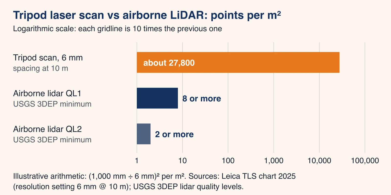
Two points per square meter is plenty to model the ground for drainage or grading. It cannot show a door frame, a pipe or a column edge. That is why airborne LiDAR feeds contour maps and terrain models, while tripod scans feed floor plans and Revit models.
Terrestrial vs mobile vs airborne LiDAR
LiDAR comes on four kinds of platform. Each trades detail for coverage.
| Platform | How it captures | Best for | Watch out for |
|---|---|---|---|
| Terrestrial (tripod) | Static setups, registered together | Buildings, plants, facades, interiors, millimeter work | Slow over large open land; needs line of sight |
| Mobile (vehicle or handheld SLAM) | Scans while moving, position from GNSS, IMU or the scan itself | Roads, corridors, quick interior capture | Accuracy depends on trajectory; usually coarser than tripod scans |
| Drone (UAV) | Low flights over a site | Sites of a few to a few hundred acres, roofs, stockpiles | FAA rules, wind, heat and battery limits |
| Airborne (aircraft) | High flights over large areas | County-scale terrain, floodplains, public elevation data | Detail limited to the quality level flown |
A fifth, phone LiDAR, sits apart. Apple says the iPad Pro's LiDAR Scanner measures distance to objects up to 5 meters away. Useful for a rough room sketch; not a substitute for a scan you will design against.
Which one fits your project?
Match the tool to what you need drawn, not to the word on a proposal. Typical Phoenix-area jobs:
| Project | Better fit | Why |
|---|---|---|
| Floor plans of an occupied office or retail center | Tripod scanning | Interior walls, doors and ceilings need millimeter detail |
| Tilt-up warehouse with racking and roof structure | Tripod scanning, from floor and lift or roof | Clear heights, joists and rooftop units are out of a drone's view from above alone |
| Rooftop units and roof equipment for a mechanical retrofit | Tripod on the roof; drone for overall context | Equipment dimensions and clearances need close range |
| Parking lot regrade or site drainage | Drone LiDAR, or tripod for a small lot | Ground surface over a large area; centimeters are enough |
| Desert parcel topography for site planning | Drone or airborne LiDAR, with a licensed surveyor for certified work | Large area, terrain model, survey control |
| Road, canal bank or utility corridor | Mobile or drone LiDAR | Long, linear coverage |
| Outdoor sports turf at a 5 mm target, registered E57 | Tripod scanning, high density | A request we were asked to quote: 5 mm calls for close-range static scans |
Can you combine LiDAR and laser scanning?
Yes, and larger projects often do. A drone flight captures roofs, grounds and the surrounding site; tripod scans capture interiors, facades and equipment. Both datasets are registered into one coordinate system, usually tied to survey control set with GNSS or a total station, and delivered as one point cloud in E57 or LAS. The key is to agree up front which areas each method covers and what tolerance each must meet, because the combined cloud is only as reliable as its weakest part.
LiDAR is also often compared with photogrammetry, which builds 3D models from overlapping photos. Photogrammetry gives rich color at low cost but depends on light and texture; LiDAR measures distance directly. Many drone flights carry both.
LiDAR and laser scanning in Phoenix conditions
- Drone rules and airspace. Drones under 55 lb flown for work operate under FAA Part 107 with a certificated remote pilot, and flights in controlled airspace, such as the area around Phoenix Sky Harbor, need an airspace authorization (FAA). Build that lead time into the schedule.
- Summer heat. Leica lists an operating range of -5 to +40 °C for the RTC360 and -20 to +50 °C for the ScanStation P-series. The NWS Phoenix 1991-2020 normal high for July is 106.5°F, about 41 °C, already above the compact scanner's limit before any sun on the case (NWS Phoenix). Our post on laser scanning in extreme heat covers scanner limits, heat shimmer and dawn scheduling.
- Monsoon season. The NWS counts the monsoon from June 15 to September 30; on August 25, 2025 a dust storm ran from the Tucson area up through Phoenix with near-zero visibility. Storms and dust ground drones and coat optics. Keep exterior and aerial work flexible in those months.
- Certified work. Neither a drone flight nor a tripod scan is a certified survey by itself. Boundary and certified topographic work in Arizona goes through a registered land surveyor.
If you are not sure which method your job needs, describe what you need drawn and the tolerance; the method follows from that. For buildings and sites in the Valley, see how LiDAR scanning in Phoenix is scoped, or send your project details for a quote.
Frequently asked questions
Is laser scanning the same as LiDAR?
Technically yes: a terrestrial laser scanner is a ground-based LiDAR instrument, since both time laser light to measure distance. In everyday use, "3D laser scanning" means tripod scanners measuring buildings to the millimeter, and "LiDAR" usually means airborne, drone or vehicle systems mapping large areas at centimeter level.
Is a LiDAR scanner accurate?
It depends on the platform. Tripod scanners publish 3D accuracy of about 2 mm at 10 m (FARO Focus i.1) to 6.4 mm at 50 m (Leica RTC360). Airborne LiDAR for the USGS 3D Elevation Program is specified at 10 cm vertical RMSE for its QL1 and QL2 levels. Phone LiDAR is meant for rough capture within about 5 m.
What is a 3D LiDAR scanner?
Any LiDAR sensor that sweeps its beam in two directions to build a 3D point cloud, rather than measuring along a single line or plane. Tripod laser scanners, drone LiDAR payloads, vehicle mapping systems and many robot sensors are all 3D LiDAR scanners.
What is a flash LiDAR?
A flash LiDAR lights the whole scene with one wide pulse and reads the returns on a grid of detectors at once, instead of steering a beam point by point. It has no spinning mirror, which suits cars and robots, but it is not the tool used to document buildings to the millimeter.
Is LiDAR better than ultrasonic?
They do different jobs. Ultrasonic sensors measure short distances with sound and are common in parking sensors and level gauges. LiDAR uses light, works over far longer ranges and produces dense 3D point clouds, which is why it is used for mapping and building documentation.
Should I use drone LiDAR or a tripod scanner for my building?
For interiors, facades, MEP and anything drawn to a tight tolerance, use a tripod scanner. A drone helps for roofs and site context over large areas. Many projects combine both, registered in one coordinate system.