
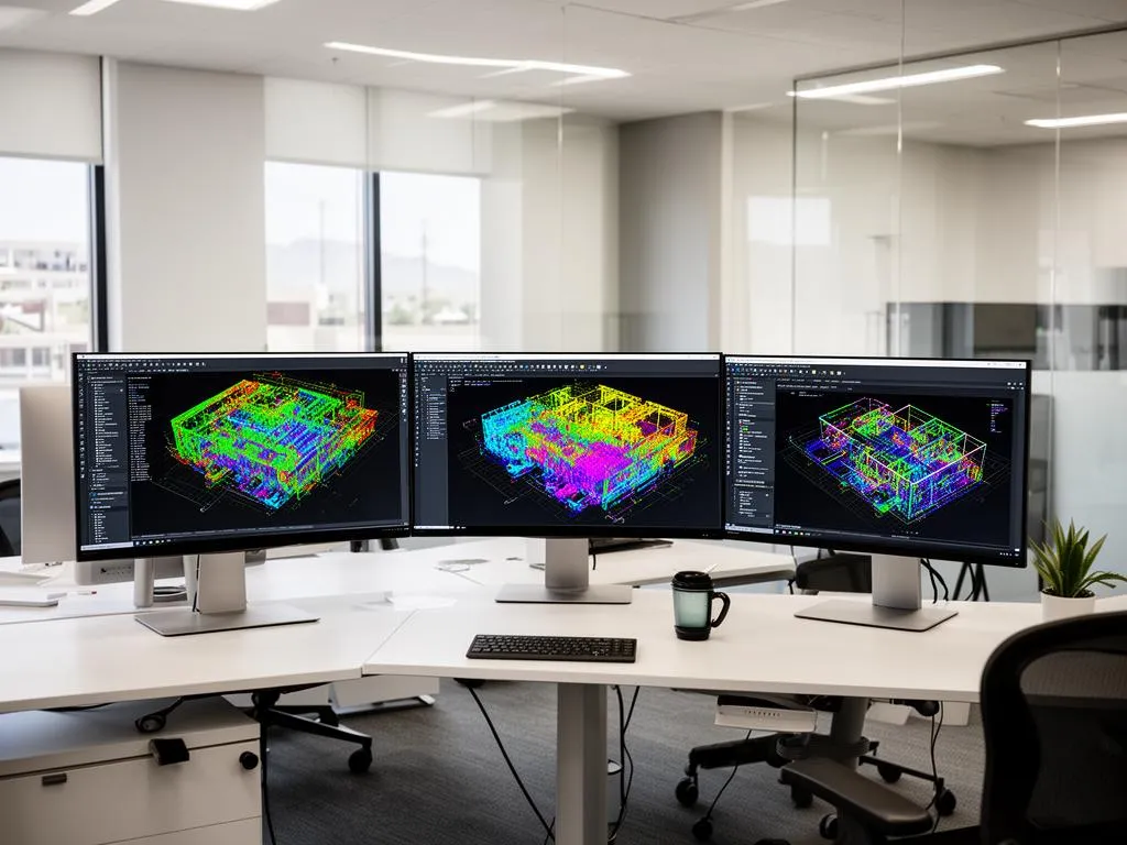
3D laser scanning in Scottsdale: what we do and how it works
3D laser scanning in Scottsdale works the same way as anywhere in the Valley: we set a tripod-mounted laser scanner at a series of positions inside and around your building, merge the scans into one point cloud, and turn that into the drawings or model your team needs. What changes in Scottsdale is the building stock and the city that issues the permit. We scan commercial and industrial buildings, not homes, and we are based in Phoenix, so Scottsdale sites are a same-day drive.
Two of the projects we have been asked to quote recently were in Scottsdale: a 3D BIM model of 5 to 6 buildings totaling about 50,000 sq ft in Old Town, for a design-build firm, and 2D CAD floor plans of two adjacent three-story office buildings totaling about 390,000 sq ft, for a commercial real estate advisor. Both asked for a fee and the earliest start date. That is typical, and this page is written around those two kinds of jobs.
Driving to Scottsdale from our Phoenix office
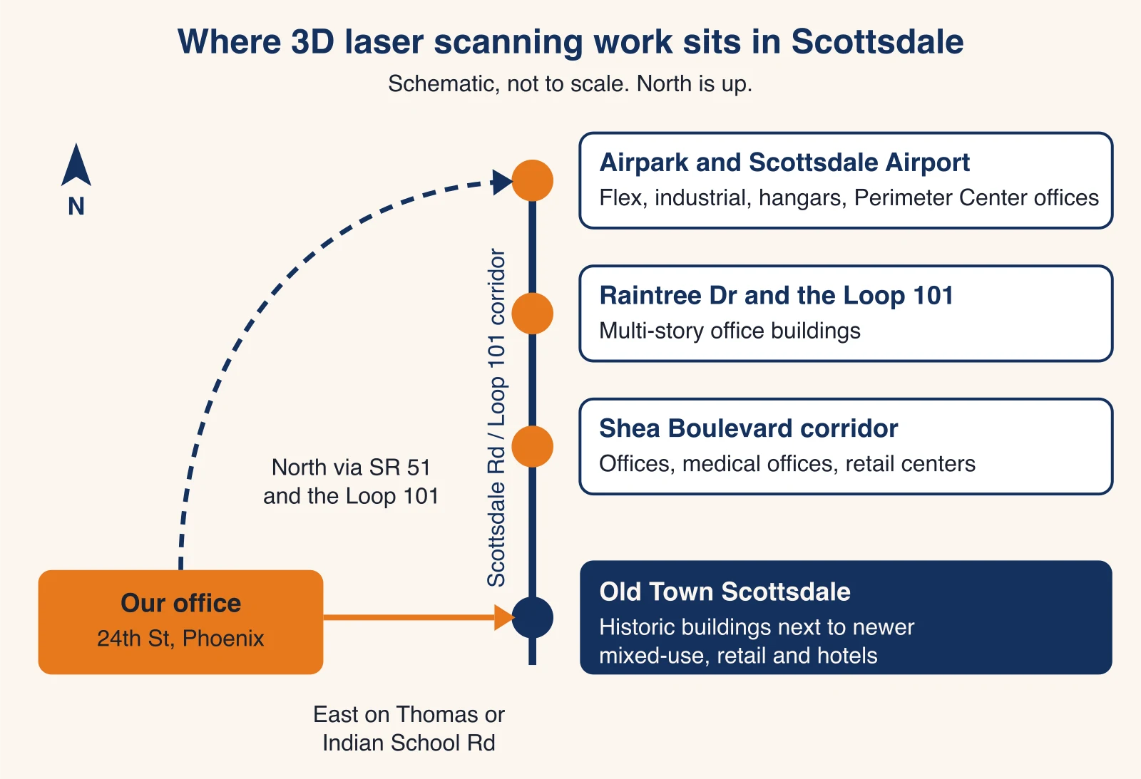
Our office is at 2942 N 24th St UNIT 114, Phoenix, AZ 85016. Old Town Scottsdale is a straight drive east along Thomas Road or Indian School Road. The Shea corridor, the Loop 101 office area and the Airpark are reached north on SR 51 and then east on the Loop 101. None of these needs an overnight stay or a separate travel day, so the crew can start early and stay on site as long as the scan needs. Any travel time is stated in the quote.
What to send for a Scottsdale laser scanning quote
Send these and you get a fee and a start date faster:
- The street address, the number of buildings and the approximate square footage (per floor if it is multi-story).
- Whether the buildings are occupied, and when we can get in: business hours, after hours or weekends.
- The deliverables: floor plans, reflected ceiling plans, elevations, sections, roof plans, a Revit model, or the point cloud only.
- The file formats your team uses (DWG, RVT, PDF, E57, RCP) and your deadline.
- Whether you need roof access or exterior façades, and any site photos you want with the files.
Request a Scottsdale laser scanning quote with those details. We typically reply within one business day.
Price range and turnaround for Scottsdale projects
Most commercial scanning projects in the Phoenix area range from $2,500 to $15,000, depending on size, complexity, level of detail, deliverable type, access and deadline. Large multi-building or multi-story scopes can sit at or above the top of that range; the quote says so up front. On-site scanning typically takes 1 to 3 days for a commercial building. Processing and drafting typically take 3 to 10 business days. Rush delivery may be available at premium pricing. The 3D laser scanning cost guide explains what moves the price.
How a Scottsdale project runs
- Consultation and quote: scope, deliverables, deadline and site access.
- On-site scanning, around tenants and staff if the building is in use.
- Registration of every scan position into one point cloud, and noise removal.
- Drafting or modeling: CAD drawings, Revit model or point cloud export.
- Delivery, then follow-up for questions, extra extractions and reasonable revisions.
Scottsdale buildings we are asked to laser scan
Scottsdale is long and narrow, and its commercial buildings cluster along a north-south line. Each cluster changes how a laser scanning job is planned.
Old Town Scottsdale: historic and mixed-use buildings
Old Town is the city's downtown. Its planning document, the Old Town Scottsdale Character Area Plan, was first adopted in 1984 as the Downtown Plan and was most recently adopted in February 2024; it covers roughly Chaparral Road to Earll Drive and 68th Street to Miller Road (City of Scottsdale, Old Town Character Area Plan). Within it, older buildings stand next to new mixed-use, hotels and retail. Listed historic properties include the 1921 Farmer's State Bank, the 1950 Western Motor Service building and the 1954 Sprouse-Reitz Drugstore (List of historic properties in Scottsdale, Wikipedia).
Why older buildings need a scan, not old drawings
Buildings that have been remodeled for decades rarely match any drawing on file. Walls are out of plumb, floors step between additions, and openings have moved. Architectural scanning records what is actually there, which is the point of an existing conditions model or drawing set for a renovation.
Scoping a multi-building Old Town model
A scope like the one we were asked to quote, 5 to 6 buildings and about 50,000 sq ft, averages roughly 8,300 to 10,000 sq ft per building (illustrative arithmetic: 50,000 divided by 6 or 5). Small buildings mean more exterior setups per square foot, shared or party walls between neighbors, separate roofs, and sidewalks and alleys to work around. Tell us which façades and roofs must be modeled and whether interiors are in scope for every building, since that drives the price more than the total square footage.
Excluded unless you ask
Spaces we cannot enter, such as a neighbor's tenant space or a locked roof, are not captured. Furniture, signage and landscaping are not modeled by default.
Office buildings along Shea Boulevard, Raintree Drive and the Loop 101
North of Old Town, Scottsdale's office space runs along Shea Boulevard and the Loop 101, including the Raintree Drive area and Perimeter Center. These are mostly occupied multi-story offices and medical offices. The usual request is 2D CAD floor plans for leasing, space planning or a tenant improvement, often for a whole building at once.
Worked example: two three-story office buildings (illustrative)
Take a request like the one we were quoted: two adjacent three-story office buildings, about 390,000 sq ft in total. If the two buildings were the same size, that is 6 floor plates of about 65,000 sq ft each (390,000 divided by 2 buildings, divided by 3 floors). Every floor plate needs its own set of scan positions, and drafting time grows with the number of rooms, not only the area: an open floor drafts fast, a floor divided into many small suites does not. So the quote depends on how the floors are built out, which is why we ask for a sample floor plan or a few photos if you have them.
Scanning occupied offices
A terrestrial scanner captures walls, ceilings and visible equipment around people and furniture, so tenants rarely have to move out. Where daytime access is a problem, after-hours or weekend scanning may be available at premium rates.
The Scottsdale Airpark and Scottsdale Airport
The area around Scottsdale Airport is traditionally called the Scottsdale Airpark, and the City describes it as the location of its largest industrial-zoned area (City of Scottsdale, Greater Airpark Character Area Plan). Expect flex and industrial shells with office build-outs, hangars, showrooms and office buildings side by side.
Flex, industrial and hangar scans
Large open volumes scan fast. The details buyers forget are the ones that matter later: clear heights, roof structure seen from below, overhead doors and rooftop units. LiDAR scanning from more positions outside also captures yards, parking and building exteriors when the scope needs them.
Hotels, resorts and retail
Scottsdale's hospitality and retail buildings are scanned for renovations, rebranding and accessibility upgrades. These buildings rarely close, so we plan scan positions around guests and opening hours, and after-hours work may be available at premium rates.
Laser scanning services available in Scottsdale
Every service we offer in Phoenix is available in Scottsdale, with the same pricing basis, accuracy and file formats.
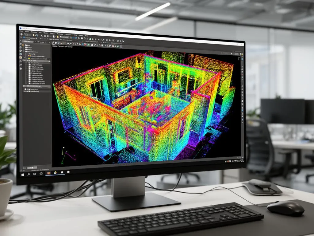
- Scan to BIM in Scottsdale: a 3D Revit model (RVT) of the existing buildings for design and coordination, the deliverable the Old Town request asked for. See scan to BIM services.
- As-built drawings: floor plans, elevations, sections and details drawn from the scan for renovations and tenant improvements. See as-built drawings and existing conditions documentation.
- Scan to CAD in Scottsdale: 2D AutoCAD drawings (DWG) traced from the point cloud, the format most property owners, brokers and architects ask for. See scan to CAD services.
- Point cloud services: the registered, cleaned point cloud in E57, RCP/RCS or LAS for teams that model in house. See point cloud services.
- LiDAR scanning: terrestrial LiDAR for large sites, exteriors and outdoor structures, such as an Airpark yard or a resort's grounds. See LiDAR scanning services.
- Building scanning: full interior and exterior capture of commercial and industrial buildings, whatever the final deliverable. See commercial building scanning.
Which deliverable fits your Scottsdale project
| If your Scottsdale project is... | You usually need | Typical files |
|---|---|---|
| A renovation of several Old Town buildings designed in Revit | Scan to BIM model of the buildings, façades and roofs | RVT, plus the point cloud |
| Leasing or space planning in a multi-story office building | CAD floor plans of every floor | DWG, PDF |
| A tenant improvement in an office, medical or retail suite | As-built floor plans and reflected ceiling plans | DWG, PDF |
| An Airpark flex or industrial building changing tenants | CAD floor plans, clear heights, roof plan, site photos | DWG, PDF, JPG |
| A team that models in house | Registered point cloud only | E57, RCP, LAS |
Accuracy you can expect
Typical accuracy is ±2 to 6 mm at normal working ranges, depending on the scanner, range and site conditions. Glass storefronts, mirrors and pools can add noise that we clean up during registration.
As-built drawings and City of Scottsdale permits
If your project needs a permit, it goes to the City of Scottsdale's Planning and Development Services, not the City of Phoenix. That matters because the process and portal are different.
How Scottsdale reviews commercial plans
The City reviews plans in five disciplines: Planning, Building, Engineering, Stormwater and Fire. Projects are managed in the Scottsdale SPUR portal, which replaced the older eServices portal for projects started from January 6, 2026. For a tenant improvement, the City lists a 7 business day administrative review and a 10 business day substantive review, and construction documents must show the location, nature and extent of the proposed work (City of Scottsdale, commercial plan review). Showing that accurately starts with knowing what is there today.
Where our as-built drawings fit
Our as-built documentation is the measured base your architect or design professional draws the permit set on. They prepare, seal or submit the package. We do not submit drawings to the City ourselves, and we never claim the City accepts our drawings directly.
What we do not provide
Our deliverables are non-certified and informational. We do not provide engineering-certified measurements or licensed land surveys. If you need a boundary or certified survey, use an Arizona-registered land surveyor; we can refer you to one.
Laser scanning services near Scottsdale
We work across the Phoenix metro with the same services and pricing. If your portfolio crosses city lines, see 3D laser scanning in Tempe, just south of Scottsdale, or browse all the cities we serve. When you are ready, send us your Scottsdale address and deliverables or call (520) 800-5310.
Frequently asked questions
Do you offer 3D laser scanning in Scottsdale, AZ?
Yes. Scottsdale is part of our regular service area. We drive to Scottsdale sites from our Phoenix office, scan on site, and process the data in our office. Old Town, the Shea corridor, the Loop 101 office area and the Airpark are all covered.
How much does 3D laser scanning or LiDAR scanning cost in Scottsdale?
Most commercial scanning projects in the Phoenix area, Scottsdale included, range from $2,500 to $15,000. The price depends on square footage, number of buildings, level of detail, deliverables, access and deadline. You get a detailed quote before any work starts, with any travel time stated.
Can I submit your as-built drawings to the City of Scottsdale for a permit?
Our drawings are non-certified measured documentation. The permit set is usually prepared, sealed or submitted by your architect or design professional, who uses our as-built drawings as the measured base. We do not submit drawings to the City of Scottsdale ourselves.
Can an iPhone or a Matterport camera replace a laser scan?
Phone LiDAR and Matterport-style cameras are good for quick visuals and marketing tours. For design work, a terrestrial laser scanner on a tripod gives a denser, more accurate point cloud, typically ±2 to 6 mm at normal working ranges. If your architect or engineer will draw from the data, ask for a terrestrial scan.
What are the downsides of LiDAR and laser scanning?
A scanner only records what it can see. Hidden framing, buried utilities and the inside of walls are not captured, and glass, mirrors and water can produce noise that needs cleanup. Our deliverables are also informational, not a licensed land survey or engineering-certified measurements.
How fast can you scan a Scottsdale office building?
A typical commercial scan takes 1 to 3 days on site, depending on size. Drawings, models or point clouds typically follow 3 to 10 business days later. Rush delivery may be available at premium pricing, and after-hours or weekend scanning may be available at premium rates for occupied buildings.